GPS는 글로벌 포지셔닝 시스템을 말합니다.
정확한 포지셔닝을 제공 할 수 있습니다, 대부분의 지구 표면의 속도 측정 및 고정밀 표준 시간 (98%), 지상 또는 지구 근처에 위치한 군용 사용자를 만족시켜 3 차원 위치를 지속적으로 정확하게 결정할 수 있습니다., 스포츠 및 시간 요구 사항에 대한 3 차원, 민간인 GPS는 또한 약 10 미터의 위치 정확도를 달성 할 수 있습니다..
개요
정의
글로벌 포지셔닝 시스템 (GPS) 미 육군이 공동으로 개발 한 차세대 우주 위성 내비게이션 및 포지셔닝 시스템입니다., 1970 년대 해군과 공군. 주요 목적은 실시간을 제공하는 것입니다, 세 가지 주요 토지 분야에 대한 전천후 및 글로벌 내비게이션 서비스, 바다와 공기, 정보 수집과 같은 군사 목적으로 그것들을 사용하기 위해, 핵 폭발 모니터링 및 비상 통신. 그것은 미국 글로벌 지배 전략의 중요한 부분입니다.. 이것은 위성 시스템으로 구성되어 있습니다 24 지구를 덮는 위성. 이 시스템은 언제든지이를 보장 할 수 있습니다, 지구상의 모든 지점은 동시에 4 개의 위성을 관찰 할 수 있습니다., 위성이 위도를 수집 할 수 있도록, 관찰 지점의 경도 및 고도, 내비게이션과 같은 기능을 실현하기 위해, 포지셔닝, 그리고 타이밍. 그만큼
소개
GPS는 차량 포지셔닝과 같은 기능을 제공 할 수 있습니다, 도난 방지, 안티 로브, 구동 경로 모니터링 및 호출 명령. 위의 모든 기능에는 GPS 터미널의 세 가지 요소가 있어야합니다., 전송 네트워크 및 모니터링 플랫폼.
작업 원칙
포지셔닝 원리
The basic principle of the GPS navigation system is to measure the distance between the known satellite and the user’s receiver, and then integrate the data of multiple satellites to know the specific position of the receiver. To achieve this purpose, the position of the satellite can be found in the satellite ephemeris according to the time recorded by the on-board clock. The distance from the user to the satellite is obtained by recording the time taken by the satellite signal to propagate to the user, and then multiplying it by the speed of light (due to the interference of the atmospheric ionosphere, this distance is not the real distance between the user and the satellite, but Pseudo-range (PR,): When the GPS satellite is working normally, 의사 랜덤 코드로 내비게이션 메시지를 지속적으로 전송합니다 (의사 코드라고합니다) 구성 1 그리고 0 이진 기호. GPS 시스템에서 사용하는 두 가지 유형의 의사 코드가 있습니다., 각각 민간인 사용을위한 C/A 코드와 P입니다.(와이) 군사 사용을위한 코드. 코드의 빈도는 1.023MHz입니다, 반복 기간은입니다 1 밀리 초, 그리고 코드 간격은입니다 1 마이크로 초, 300m에 해당합니다; P 코드의 빈도는 10.23MHz입니다, 그리고 반복 기간은입니다 266.4 날. 코드 간격이 있습니다 0.1 마이크로 초, 이는 30m에 해당합니다. Y 코드는 P 코드를 기준으로 형성됩니다., 더 나은 기밀이 있습니다. 내비게이션 메시지에는 위성 ephemeris가 포함됩니다, 작업 상태, 시계 보정, 전리층 지연 보정, 및 대기 굴절 보정. 및 기타 정보. 위성 신호로부터 탈선되고 50b/s 변조로 캐리어 주파수에서 전송된다.. 내비게이션 메시지의 각 메인 프레임에는 포함됩니다 5 서브 프레임과 각 프레임의 길이는 6s입니다. 처음 세 프레임에는 각각이 있습니다 10 코드; 그것은 매번 반복합니다 30 매시간 초 및 업데이트. 마지막 두 프레임은 총 15000b입니다. 내비게이션 메시지의 내용에는 주로 원격 측정 코드가 포함됩니다., 변환 코드, 그리고 데이터 블록 1, 2, 그리고 3, 가장 중요한 것은 ephemeris 데이터입니다. 사용자가 내비게이션 메시지를받을 때, 위성 시간을 추출하고 위성과 사용자 사이의 거리를 알기 위해 자신의 시계와 비교하십시오., 그런 다음 내비게이션 메시지에서 위성 ephemeris 데이터를 사용하여 메시지가 시작될 때 위성의 위치를 계산하십시오. , 사용자의 위치, WGS-84 지정 좌표계의 속도 및 기타 정보를 알 수 있습니다..
GPS 내비게이션 시스템의 위성 부분의 역할은 내비게이션 메시지를 지속적으로 전송하는 것임을 알 수 있습니다.. 하지만, 사용자의 수신기와 위성의 온보드 시계가 사용하는 시계가 항상 동기화 될 수는 없기 때문에, 사용자의 3 차원 좌표 외에도 x, 와이, 지, ΔT, 위성과 수신기의 시차, 미지의 것으로 소개해야합니다. 그런 다음 사용하십시오 4 이것들을 해결하기위한 방정식 4 미지의. 수신기가 어디에 있는지 알고 싶다면, 적어도 신호를받을 수 있어야합니다. 4 위성.
GPS 수신기는 타이밍에 사용할 수있는 나노 초 수준으로 정확한 시간 정보를받을 수 있습니다.; 향후 몇 개월 안에 위성의 대략적인 위치를 예측하는 데 사용되는 예측 ephemeris; 방송에 필요한 위성 좌표를 계산하는 데 사용되는 방송 ephemeris , 정확도는 몇 미터에서 수십 미터입니다 (각 위성과는, 언제든지 변경됩니다); 및 GPS 시스템 정보, 위성 상태와 같은, 등.
위성에서 수신기까지의 거리는 GPS 수신기의 코드를 측정하여 얻을 수 있습니다.. 수신기의 위성 시계의 오류와 대기 전파 오류가 포함되어 있기 때문입니다., 유사성이라고합니다. CA 코드로 측정 된 의사 범위는 CA 코드 의사 부위라고합니다., 그리고 정확성은 거의 없습니다 20 미터. P 코드로 측정 된 의사 범위는 P 코드 의사 범위라고합니다., 그리고 정확성은 거의 없습니다 2 미터.
GPS 수신기는 수신 된 위성 신호를 디코딩하거나 다른 기술을 사용하여 캐리어에서 변조 된 정보를 제거합니다., 그런 다음 캐리어를 복원 할 수 있습니다. 엄격하게 말하면, 캐리어 단계를 캐리어 비트 단계라고해야합니다., 이는 도플러 주파수 이동에 의해 영향을받는 수신 된 위성 신호의 캐리어 위상과 수신기의 로컬 진동에 의해 생성 된 신호의 위상 사이의 차이입니다.. 일반적으로, 수신기 시계에 의해 결정된 시대 시간에 측정됩니다., 위성 신호를 추적하여 위상 변화 값을 기록 할 수 있습니다., 그러나 관찰 시작시 수신기의 위상과 위성 발진기의 초기 값은 알려져 있지 않습니다., 처음에는 첫 번째 시대의 위상 정수도 알려져 있지 않습니다., 즉, 정수 모호성, 데이터 처리의 매개 변수로만 해결할 수 있습니다.. 위상 관측 값의 정확도는 밀리미터만큼 높습니다., 그러나 전제는 전체 원의 모호성을 해결하는 것입니다.. 그러므로, 위상 관찰 값은 상대 위치 및 연속 관찰 값이있을 때만 사용할 수 있습니다., 그리고 포지셔닝 정확도는 미터 레벨보다 더 나은 것만 달성 할 수 있습니다.. 위상 관찰을 사용할 수 있습니다.
위치에 따라, GPS 포지셔닝은 단일 포인트 포지셔닝 및 상대 위치로 나뉩니다. (차동 위치). 단일 포인 포지셔닝은 수신기의 관찰 데이터를 기반으로 수신기의 위치를 결정하는 방법입니다.. 의사 범위 관측 만 사용할 수 있으며 차량 및 선박의 대략적인 탐색 및 포지셔닝에 사용할 수 있습니다.. 상대 위치 (차동 위치) 둘 이상의 수신기의 관찰 데이터를 기반으로 관찰 지점 사이의 상대 위치를 결정하는 방법입니다.. 의사 범위 관찰 또는 위상 관찰을 사용할 수 있습니다. 지정 설문 조사 또는 엔지니어링 설문 조사는 상대 위치에 위상 관찰을 사용해야합니다..
GPS 관찰에는 위성의 시계 오류 및 수신기와 같은 오류가 포함됩니다., 대기 전파 지연, 그리고 다중 경로 효과. 포지셔닝 계산은 위성 방송 ephemeris 오류의 영향을받습니다., 그리고 상대 위치를 수행 할 때 대부분의 일반적인 오류가 제거됩니다.. 상쇄 또는 약화, 따라서 포지셔닝 정확도가 크게 향상됩니다. 이중 주파수 수신기는 두 주파수의 관찰에 따라 대기의 전리층 오차의 주요 부분을 상쇄 할 수 있습니다.. 정확도가 높고 수신기 사이의 거리가 길면 (분위기에는 명백한 차이가 있습니다 ), 이중 주파수 수신기를 선택해야합니다.
GPS 포지셔닝의 기본 원리는 공간 거리 절제술 방법을 사용하여 알려진 시작 데이터로서 고속 이동 위성의 순간 위치에 따라 측정 될 지점의 위치를 결정하는 것입니다.. 그림에서 볼 수 있듯이, 지점에서 GPS 수신기가 설치되어지면에서 측정 될 때 T Time t에서 측정된다고 가정합니다., gps 신호가 수신기에 도착하는 시간 Δt를 측정 할 수 있습니다., 위성 ephemeris 및 수신기 방정식으로 수신 된 기타 데이터를 추가하여 다음 4 가지 요소를 결정할 수 있습니다..
위치 정확도
28 위성 (포함 4 저장) 이미 우주로 발사되었습니다, 그리고 그들은 배포됩니다 6 교차로가있는 궤도 평면 60 학위, ~에 대한 20,000 지상 킬로미터. 독립형 내비게이션의 정확도가 있습니다 10 미터, 통합 포지셔닝의 정확도는 센티미터 및 밀리미터 수준에 도달 할 수 있습니다.. 그러나 민간 분야에서 개방의 정확성은 10 미터.
요소
우주 부분
GPS의 공간 부분은 구성됩니다 24 위성 (21 작업 위성; 3 예비 위성), 지구 표면에서 20200km 이상 하늘에 위치한, 작동주기는 12 시간입니다. 위성은 고르게 분포되어 있습니다 6 궤도 평면 (4 각 궤도 평면에서), 궤도 성향은 55 °입니다. The distribution of satellites makes it possible to observe more than 4 satellites anywhere in the world at any time, and can pre-store navigation information in the satellites. Due to problems such as atmospheric friction, the navigation accuracy of GPS satellites will gradually decrease over time. .
ground control system
The ground control system consists of the Monitor Station, the Master Monitor Station, and the Ground Antenna. The Master Control Station is located in Springfield, Colorado, USA. The ground control station is responsible for collecting the information sent back by the satellite, and calculating the satellite ephemeris, relative distance, atmospheric correction and other data.
User equipment part
The user equipment part is the GPS signal receiver. Its main function is to be able to capture the satellites to be measured selected according to a certain satellite cut-off angle, and track the operation of these satellites. When the receiver captures the tracked satellite signal, it can measure the pseudo-range and distance change rate from the receiving antenna to the satellite, and demodulate the satellite orbit parameters and other data. According to these data, the micro-processing computer in the receiver can perform positioning calculation according to the positioning solution method, and calculate the latitude and longitude, altitude, 속도, time and other information of the user’s geographic location. Receiver hardware and built-in software as well as post-processing software package for GPS data constitute a complete GPS user equipment. The structure of the GPS receiver is divided into two parts, the antenna unit and the receiving unit. The receiver generally adopts two kinds of DC power sources, inside and outside the machine. The purpose of setting the internal power supply is to continuously observe without interruption when the external power supply is replaced. The internal battery is automatically charged when the external power supply is used. The built-in battery powers the RAM memory after shutdown to prevent data loss. Various types of receivers are getting smaller and lighter in size, which are convenient for field observation. The second is user receivers. There are currently two types of single-frequency and dual-frequency receivers. 하지만, due to price factors, most users buy single-frequency receivers.
Market development
The market potential of China’s GPS navigation is huge. By the end of 2005, there were less than 100,000 vehicles with on-board navigation equipment in China, and compared to the total number of 30 million vehicles, the penetration rate was less than 1%. 일본에서, the car navigation installation rate is as high as 59%, and in Europe and the United States accounts for about 25%. ~ 안에 2006, the portable navigation market should have a scale of nearly 500 million yuan. With the rapid development of the market and the emergence of new brands, it is estimated that the sales of China’s car GPS navigation system terminals will be close to 10 billion yuan in 2009.
2008 is known as the “first year of 3G” in China. As we all know, in the field of domestic communications, the hottest is the TD-SCDMA——3G standard that is in trial operation. As a new generation of communication technology, 3G brings people a lot of expectations. The full issuance of 3G licenses has also become the focus of common attention. 사실은, the domestic GPS navigation field is also undergoing a transformation. The third generation of PND navigation products has emerged as the times require, which has brought people into a new era of navigation.
The satellite navigation application industry is playing an increasingly important role in the national economy and will become the highlight of the Eleventh Five-Year Plan. During the “Eleventh Five-Year Plan” period, satellite navigation will be used in other fields such as aviation, sea, railway, 건설, and telecommunications There will be a lot of room for development in applications such as electricity and electricity.
The development trend of satellite navigation technology is mainly manifested in three aspects: 첫 번째, the coexistence of multiple systems of satellite navigation, which improves the availability of the system and expands the application field; second, the multi-component navigation technology is being promoted and applied, mainly including GPS and mobile communication The combined application of base station positioning, gyroscope, dead reckoning technology, 등.; the third is the combination of satellite navigation and other high technologies such as wireless communication, such as GPS receivers embedded in cellular phones, portable PCs, PDAs and watches, 등. 의사소통, security and consumer products Electronic products fundamentally promote the overall development of IT technology.
How to buy
품질
When choosing GPS navigation products, the configuration of software and hardware is very important. 일반적으로 말하면, the hardware configuration of professional brand manufacturers is more trustworthy. Some counterfeit GPS manufacturers often fabricate hardware configurations, making it difficult to guarantee product quality in terms of LCD screens, GPS chips, and processors. The production process of their entire GPS product is nothing more than simple integration and assembly of some hardware. The hardware configuration of regular GPS manufacturers often has to go through layers of checks, and must pass ISO quality production standards (mainly ISO2000 quality certification, ISO14001 environmental certification) and other certifications. For automotive products, only through “ISO/TS TS16949 standard certification” can we supply products and services to Mercedes-Benz, Volkswagen and other automobile manufacturers.
Software
In terms of software, the most concerned is naturally the accuracy of GPS navigation map data and the timeliness of updates. Frequent updating of maps has resulted in high production costs of electronic maps, so many unqualified GPS manufacturers will reduce map updates or pirate other electronic maps. If consumers use “fake and shoddy” maps for machine navigation, they will not only easily “go astray”, but may even be life-threatening.
상표
사실은, the importance of the brand far exceeds the other. Since the satellite navigation industry in China is a high-tech industry in the development stage, only those professional manufacturers who have been working in the market for many years can guarantee the leading edge in product technology, and at the same time have the funds and strength to provide users with comprehensive and excellent service guarantee .
The price of the product and after-sales service are also the main factors to consider when purchasing a product. Consumers hope to buy high-quality and low-cost products, but the result may not be what they want. Many navigation products on the market are “cheap” but not “good quality”. 그러므로, consumers are reminded here not to be blinded by simply abnormal low prices when purchasing products. For navigation products that are closely related to your own driving travel and travel adventures, you must not be stingy to pay for your own “travel safety”.
As a GPS navigation product, the upgrade of product technology and the update of map data are very important. Only professional brand manufacturers can provide consumers with such services in a timely manner.
Misunderstanding
After the third consecutive drop in oil prices, it ushered in a third consecutive rise. Newbies who just bought a car are even more worried that they will go the wrong way, and any fuel-efficient driving habits will be in vain. 그러므로, after buying a car, more and more rookies will consider buying a car navigator. 하지만, the reporter found that, in addition to the defects of the navigation product itself, car owners have some misunderstandings no matter in the static test when purchasing or in the actual application process.
Don’t be superstitious about the speed of star search when purchasing
대개, in the store where the GPS navigator is purchased, the salesperson will show consumers how fast the product’s satellite reception signal is. 대개, GPS is divided into three methods: hot start, cold start and warm start. 하지만, in the process of selling navigators, some salesmen deliberately changed the concept and used GPS in different states to compare the search speed. 일반적으로, when it is used for the first time, the battery is exhausted and the information is lost, or the receiving device is moved more than 1000 kilometers in the off state, the GPS cold start positioning speed is much slower than the hot start positioning speed.
사실은, many consumers value ultra-fast positioning, but the super-fast search star shown by the sales staff may not be really fast, because it is necessary to distinguish the different states of hot and cold starts. 예를 들어, some GPS products on the market are equipped with HotFix ultra-fast positioning technology. , Compared with other products without ultra-fast positioning technology, the positioning speed is more than twice as fast.
More languages are not more practical
In practical applications, in most cases, the voice of the product is used to navigate. 그러므로, more and more products have an additional selling point of “multilingual selection”. In addition to the most common Mandarin and English, Cantonese and Hakka also appear. , Chaozhou dialect, Northeast dialect, Sichuan dialect and other dialects. 그러므로, some consumers feel that its “language ability” is super strong when purchasing. 하지만, some consumers reported after using it that in fact, it is always Mandarin that can best express the actual situation on the road. Other languages only mechanically express simple information such as road names and distances in local dialects. 그러므로, in the expression of navigation information, people feel weird.
Compare the route planning of ultra-distance attractions
When choosing a navigation product, the speed of its route planning and calculation speed is an important aspect to measure the quality of the product. 그러므로, some consumers like to input local road information to test the operation of the product when purchasing, but this is not enough. You can try to set some extremely distant places, such as Tibet, Xinjiang, Inner Mongolia, Jilin and other tourist attractions as destinations, to test the calculation speed of the machine. 게다가, it is better to enter several more such remote destinations. During the use, the reporter found that if the Potala Palace in Tibet is set as the destination, some products can plan the route relatively quickly, but if some scenic spots in Jilin and Inner Mongolia are set as the destination and let it calculate, the product will gradually There is a phenomenon of slow operation or even crash. If the progress of each calculation state of the machine can be completed in a short time from 0% 에게 100%, it proves that its operation quality can be guaranteed. 하지만, if some machines appear very slow or even crash when the display reaches 60%-70%, this kind of machine is obviously not suitable for consumers who like to travel by car.
Enter points of interest to compare the amount of map information
Most brands of GPS navigators on the market will choose a fixed electronic map provider to cooperate with. 하지만, it should be noted that this kind of electronic map that meets the national publishing qualification generally has the same data information, but there are differences between the north and the south. Some companies’ electronic maps are aimed at the southern market. 그러므로, users will find that the amount of information on some local points of interest will be very rich. Taking some real estate in the suburbs as an example, an electronic map that mainly focuses on the southern market, even The names of different districts can be displayed. And some electronic maps that focus on the northern market can’t even find this real estate. 그러므로, when purchasing, consumers can compare whether the information content of electronic maps of different products is rich according to their own needs. 예를 들어, after selecting Chancheng District, you can enter the names of some chain catering companies to see which one is more detailed in the same area. 결과적으로, some maps showed two dozen, but others only showed a dozen.
Don’t judge the pros and cons of products based on familiar routes
When purchasing, many people will immediately input the departure and destination of their frequent driving to see if the route it guides matches their frequent driving route, so as to judge the quality of the product. Actually, this is not entirely true. Some car owners who often use the navigator said that under the premise of no traffic jams, the route recommended by the navigator is often closer. It can be seen that if the car owner is more familiar with the departure and destination, it is easy to doubt the guiding route of the navigator. 하지만, although the route guided by the navigator is relatively close, there will also be situations where the road conditions guided by the navigator are extremely poor, or even difficult to pass.
GPS
정의
The GPS positioning system refers to a system that uses satellites to perform real-time positioning and navigation around the world, referred to as GPS (글로벌 포지셔닝 시스템). The function of GPS positioning system must have three elements: GPS terminal, 전송 네트워크 및 모니터링 플랫폼; these three elements are indispensable; through these three elements, functions such as vehicle anti-theft, 안티 로브, driving route monitoring and call command can be provided.
Constitute
우주 부분
The space part of the GPS positioning system is composed of 24 GPS working satellites. These GPS working satellites together form the GPS satellite constellation, of which 21 are satellites that can be used for navigation, 그리고 3 are active backup satellites. These 24 satellites are distributed around the earth in six orbits with an inclination angle of 55°. The orbital period of the satellite is about 12 sidereal hours. Each GPS working satellite sends out a signal for navigation and positioning. It is these signals that GPS users use to do their work. It can be seen that the function of the satellite part of the GPS positioning system is to continuously transmit navigation messages.
Control section
The control part of the GPS positioning system is composed of a monitoring system composed of several tracking stations distributed around the world. According to their different functions, these tracking stations are divided into master control stations, monitoring stations and injection stations. The function of the main control station is to calculate the satellite ephemeris and the correction parameters of the satellite clock based on the observation data of the GPS by each monitoring station, and inject these data into the satellite through the injection station; Control, issue instructions to the satellite, when the working satellite fails, dispatch the spare satellite to replace the failed working satellite; in addition, the main control station also has the function of the monitoring station. The role of the injection station is to inject the satellite ephemeris and satellite clock corrections calculated by the master control station into the satellite.
User part
The user part of the GPS positioning system is composed of a GPS receiver, data processing software and corresponding user equipment such as computer meteorological instruments. Its function is to receive signals from GPS satellites and use these signals for navigation and positioning.
The above three parts together form a complete GPS positioning system.
특징
The GPS positioning system has the characteristics of good performance, high precision and wide application. It is the best navigation and positioning system so far. With the continuous improvement of the global positioning system, the continuous improvement of hardware and software, the application field is constantly being developed, and it has spread to various sectors of the national economy, and has gradually penetrated into people’s daily life.
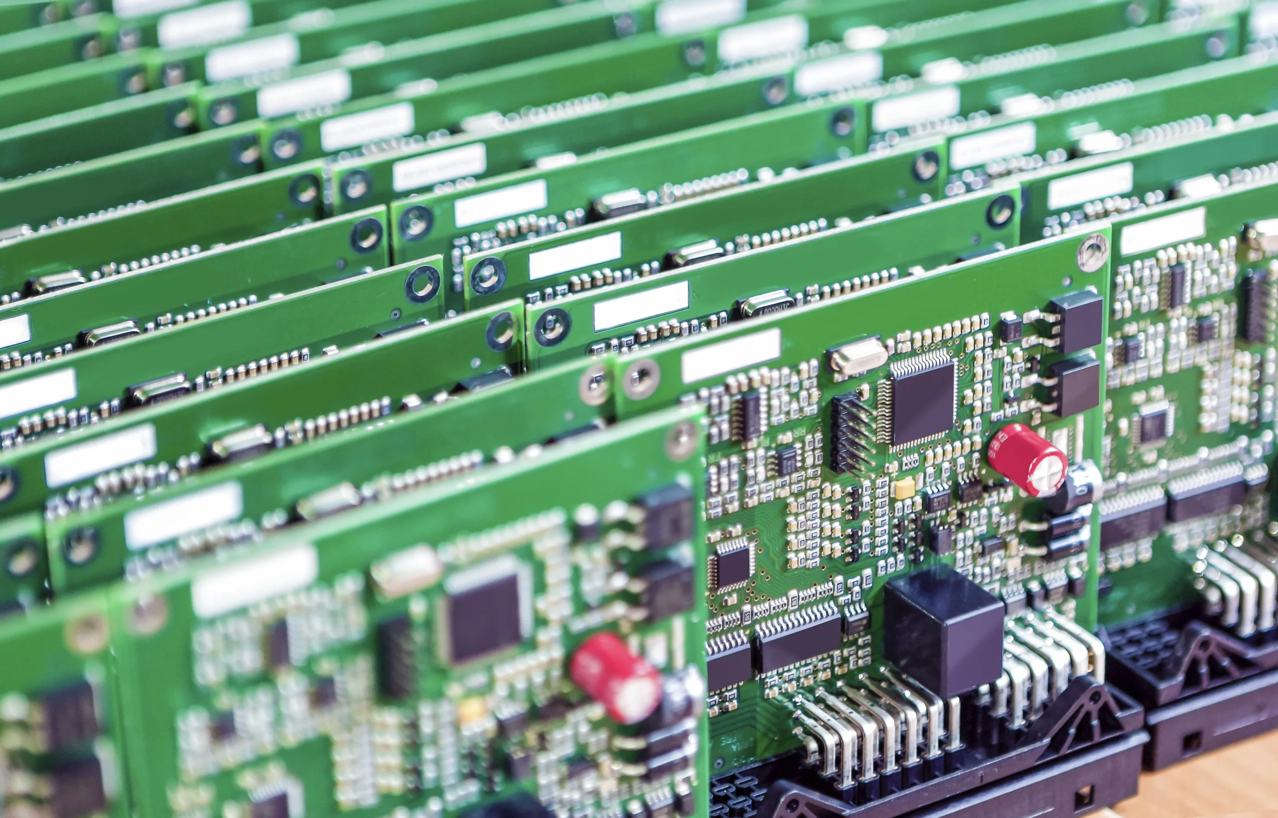
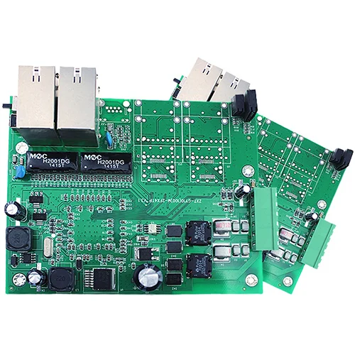
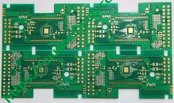
UGPCB provides Bulk GPS circuit board assembly services. 고위 산업 경험을 갖춘 PCBA 원스톱 조립 공장입니다.. 우리를 알게 된 것을 환영합니다.


